Showing posts with label Map. Show all posts

Tuesday, 15 May 2012

Latin America's Political Geography Today

Most countries later achieved independence in the 19th century, forming Latin America's political geography as we know it today.


The culture and traditions of Latin America have transformed with time, however indigenous populations still celebrate their cultural traditions, as seen in the images below.
 

Languages of Latin America

There is a wide range of indigenous languages spoken within Latin America. While the majority of people today speak Spanish, as well as languages such as Portuguese, Dutch, French and English, this was not always so.  
The maps below visually portrays the indigenous languages spoken throughout Latin America. The first map pertains to Meso-America, and the second map, South America.


File:SouthAmerican families 02.png

The map below contains the most popular and widely spoken indigenous languages.
Blue is Quechua, Yellow is Guarani, Orange is Aymara, Red is Nahuatl, Green is Lenguas Mayas, and Black is Mapudungun.

File:Map-Most Widely Spoken Native Languages in Latin America.png

Monday, 14 May 2012

A look at Latin America's geography

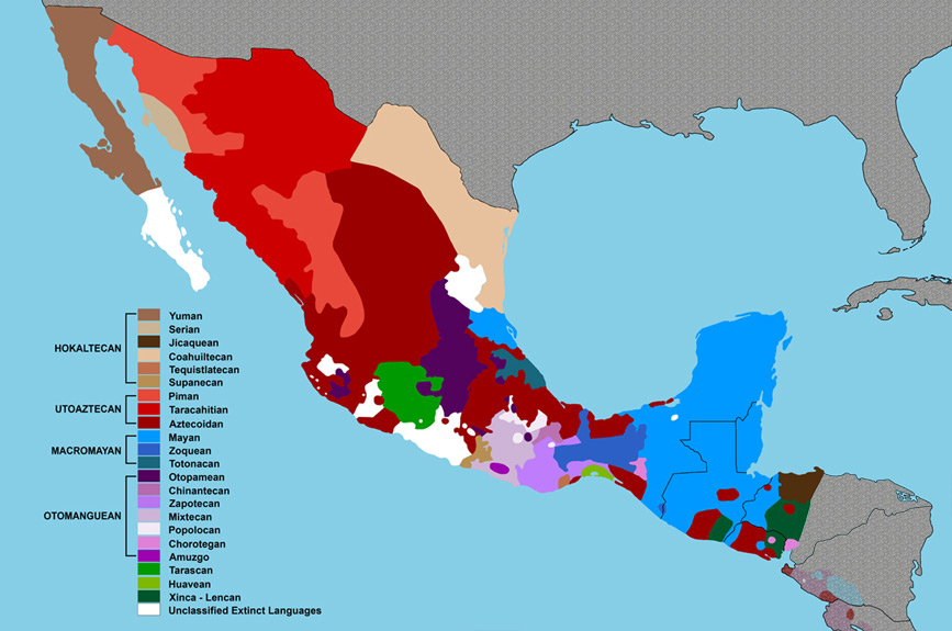
Latin America is a land full of many geographical regions.  Each region can be found on the map below, and is color coded.  In addition, Latin America is home to many rivers such as the Amazon, and mountain ranges such as the Andes.  It is located between two major oceans, the Pacific and the Atlantic, and encompasses the Gulf of Mexico.
To further develop our understanding of these regions, I will post a few pictures and point out some of the main features of each region.

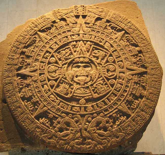
Cordillera Ranges, Intermontane Plateaus and Basins:
This region, which stretches from Mexico down to Bolivia, is the most extensive, as well as the most populated region.  It contains Latin America's greatest mountain range, as seen below. Additionally, the fertile valleys and plateaus are a great source of livelihood for many inhabitants. Having been to Bolivia and done a bit of touring in the area, I though I would upload my own photos of this region.  It is an absolutely gorgeous place and I have a lot of great memories.


Gulf Caribbean Coastal Lowlands:
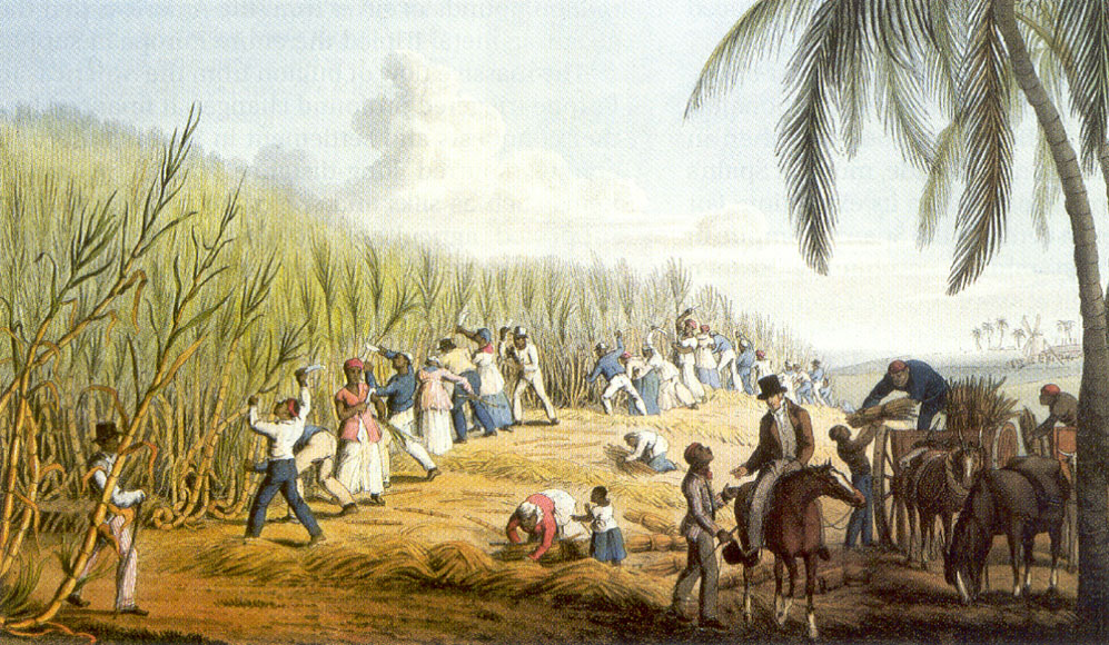
The Gulf Coast which extends from Mexico to Columbia is a popular tourist destination, (one which I have visited myself!) because of its warm climate and tropical landscape, and warm waters.  Below is a picture of my own experience with the Gulf Caribbean Coastal Lowlands.
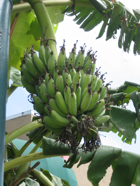

Pacific Littoral
The Pacific Littoral region extends, as its name suggests, along the Pacific Coast.  The area is narrow, as it is a coastal region.  Additionally it tends to be quite humid in this area.  In places such as Equador, this area is used for growing fruit crops such as bananas.  


Antilles
The Antilles are a group of islands situated in the middle of the Caribbean Sea.  Many of them are settled by  people of African descent.  This region thrives on tourism, and subsistence agriculture.  


Orinoco Llanos
This small plains region in Columbia and Venezuela, lies between the Andes and Guiana highlands.  It a region that is sparsely populated but contains a lot of natural resources.  
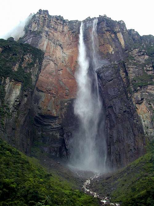
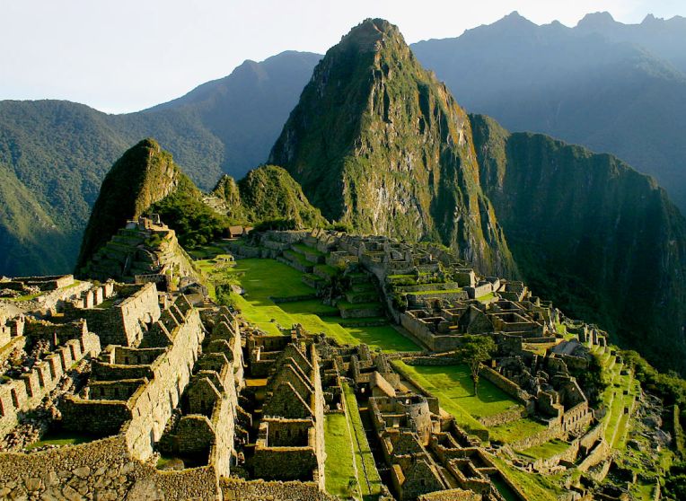
Guiana Highlands:
This area contains some of the world largest waterfalls, and is full of natural resources.  This place looks stunning! I would love to travel here one day.  
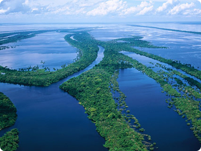
Amazonia:
This region contains the Amazon rain-forest, as well as the Amazon river.  Although not many inhabitants settle in this region, there is abundant wildlife.  A major environmental concern is the destruction of the rain-forest.


Brazilian Highlands:
The Brazilian highlands is a region of rapid population growth.  With its subtropical climate ideal for growing crops such as coffee, this region is attracting a lot of people.  Some of Latin America's largest cities also reside in this region which covers most of Brazil and is situated on South America's west coast.  It is a diverse region that contains rain-forest, plateaus and mountainous areas full of mineral deposits.

Peruvian Atacama Desert
This small region located on the Pacific Coast in Peru is one of the dries places in the world due to the winds and currents that prevail in this area.  The El Nino phenomenon occurs often here.  


Middle and South Chile:
This area has an almost dry summers and mild winters with lots of precipitation.  There is lots of foresting activity, farming and mineral deposits in this region.  


Patagonia:
Much of this region lies in Argentina.  The area contains both desert and highlands suitable for farming when irrigated. 

Plata-Parana Basin
This final region is located on the SE coast of South America.  This region has some of the best soil in the world, and therefore is conducive to agriculture.


Post-Conquest Latin America


Latin America, after the Spanish and Portuguese conquests, looked much different than pre-conquest Latin America.  Indigenous populations were wiped out by diseases, and defeated by the superior war tactics of the Europeans.  Native populations were subjugated to the Spanish and Portuguese and regions were divided into Viceroyalty's as seen below. 


When the Spaniards arrived in Latin America, they instuted slavery.  However the spaniards gave their slaves much more freedom than the British colonies in the United States did, allowing them to read and write.


Under the Spanish control, Indigenous art and architecture also changed.  The Spanish believed they were in charge of the souls of the local inhabitants, and began to build churches and send missionaries among them.  The cathedral in Mexico City, is only one example of the Spanish influence on the arts in Latin America.
Metropolitan Cathedral

Pre-Conquest Latin America Indigenous Cultures


Latin America, prior to the conquests, was comprised of various indigenous cultures.  The map below outlines where various of these cultures were situated.  


Arawak:
The Arawak were situated throughout South America.  They actually originated in the area that was later occupied by the Caribs, who defeated them (the Lower Antilles).  They are thought to have been the first indigenous population to meet Columbus as seen below.


Aztecs:
The Aztecs, situated in current day Mexico, were believed to have sacrificed humans on pyramids such as the one depicted below.  The Aztec calendar is one of the most famous indigenous sculptures and portrays the Aztec universe.  

Caribs:
As their name suggests, the Caribs were an indigenous population that resided along the northern coast of South America, and the lower Antilles.  Because of their proximity to the ocean, they were skilled sailors and boat-makers.  
A Carib Family
A Carib Building a Boat
Mayans:
The Mayans, are also known for the religious architecture and artifacts.  Below can be found a Mayan ruin, as well as a sample of pre-Columbian ceramics.  
Mayan History

mayan sacrifial flayed head red slip cup
Mixtec/Zapotec
These two groups were the largest indigenous groups in Southern Mexico.  
Below is a video clip which speaks more about this culture and Zapotec lifestyle.


Muisca:
The Muisca were an indigenous group largely situated in Columbia.  Several of their economic activities including mining, farming and weaving.  The Muisca are also very well known for their gold work. Below is an image of this famed gold work.  
Muisca raft Legend of El Dorado Offerings of gold.jpg

Below is a image of Muisca temple ruin, it is believed that the Muisca's did offer child sacrifices to their gods.

File:Villa de Leyva el infiernito.jpg


Incas:
The Inca's were arguably the most civilized indigenous population.  Machu Picchu, a popular tourist destination, is home to thousands of Inca artifacts, including the ones below.

Totanac:
The Totanac resided in eastern Mexico upon the arrival of the Spanish.  They are well known for the vanilla which they produced (and still produce!) Their economy was based mainly on agriculture, but they also were excellent weavers.  In the image below, several Totanacs perform the Voladores, a ritual which is believed to be performed to ask the gods to bring rain, or end a drought.  

A Totanac Weaving Sample


Tupi:
The Tupi were a cannibalistic tribe that lived along Brazil's Atlantic coast.  The scarce amount of literature found on the Tupi Indians would indicate that not much is known about them.  They were largely wiped out due to European slavery and diseases. The painting below was done by Alberta Eckhout, a Dutchman who was encouraged to record and paint this strange new land (Brazil).